
Alexandria topographic map
Interactive map
Click on the map to display elevation.
About this map
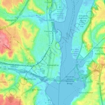
Name: Alexandria topographic map, elevation, terrain.
Location: Alexandria, Virginia, United States of America (38.78448 -77.14436 38.84501 -77.03704)
Average elevation: 39 m
Minimum elevation: -3 m
Maximum elevation: 105 m
Other topographic maps
Click on a map to view its topography, its elevation and its terrain.