
Ondo topographic map
Interactive map
Click on the map to display elevation.
About this map
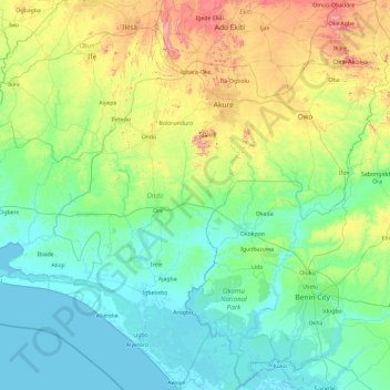
Name: Ondo topographic map, elevation, terrain.
Location: Ondo, Nigeria (5.88740 4.37612 7.75025 6.00413)
Average elevation: 154 m
Minimum elevation: -2 m
Maximum elevation: 873 m