
Widnes topographic map
Interactive map
Click on the map to display elevation.
About this map
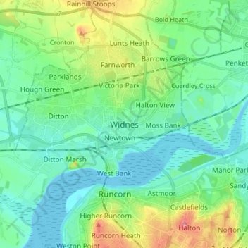
Name: Widnes topographic map, elevation, terrain.
Average elevation: 24 m
Minimum elevation: 0 m
Maximum elevation: 95 m
Other topographic maps
Click on a map to view its topography, its elevation and its terrain.
Runcorn
United Kingdom > England > Halton
Runcorn, Halton, Liverpool City Region, England, WA7 1NE, United Kingdom
Average elevation: 22 m
Weston
United Kingdom > England > Halton > Runcorn
Weston, Runcorn, Halton, Liverpool City Region, England, WA7 4RB, United Kingdom
Average elevation: 27 m