
Lelep topographic map
Interactive map
Click on the map to display elevation.
About this map
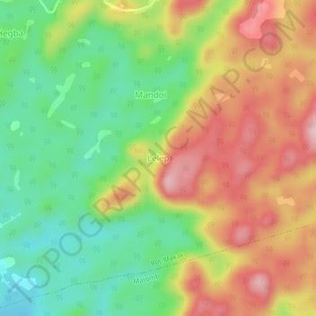
Name: Lelep topographic map, elevation, terrain.
Location: Lelep, Nyong-et-Kéllé, Centre, Cameroon (3.94071 11.08300 3.98071 11.12300)
Average elevation: 590 m
Minimum elevation: 469 m
Maximum elevation: 730 m