
McIntyre topographic map
Interactive map
Click on the map to display elevation.
About this map
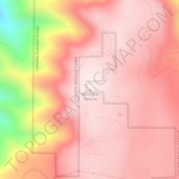
Name: McIntyre topographic map, elevation, terrain.
Location: McIntyre, Umatilla County, Oregon, United States (45.80486 -118.11540 45.80496 -118.11530)
Average elevation: 1,453 m
Minimum elevation: 983 m
Maximum elevation: 1,616 m
Other topographic maps
Click on a map to view its topography, its elevation and its terrain.
Hermiston
United States > Oregon > Umatilla County > Hermiston
Hermiston, Umatilla County, Oregon, 97838, United States
Average elevation: 160 m