
Bristol topographic map
Interactive map
Click on the map to display elevation.
About this map
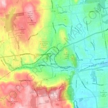
Name: Bristol topographic map, elevation, terrain.
Average elevation: 159 m
Minimum elevation: 57 m
Maximum elevation: 313 m
Other topographic maps
Click on a map to view its topography, its elevation and its terrain.
Bristol
United States of America > Connecticut > Bristol > Bristol
Bristol, Hartford County, Connecticut, 06011, United States of America
Average elevation: 156 m