
Browns Mountain topographic map
Interactive map
Click on the map to display elevation.
About this map
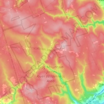
Name: Browns Mountain topographic map, elevation, terrain.
Average elevation: 227 m
Minimum elevation: 53 m
Maximum elevation: 308 m
Other topographic maps
Click on a map to view its topography, its elevation and its terrain.
Maryvale
Canada > Nova Scotia > Municipality of the County of Antigonish
Maryvale, Municipality of the County of Antigonish, Antigonish County, Nova Scotia, Canada
Average elevation: 120 m