
Balgach topographic map
Interactive map
Click on the map to display elevation.
About this map
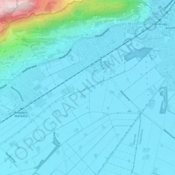
Name: Balgach topographic map, elevation, terrain.
Location: Balgach, Wahlkreis Rheintal, St. Gallen, 9436, Switzerland (47.37944 9.58291 47.41430 9.62665)
Average elevation: 440 m
Minimum elevation: 399 m
Maximum elevation: 813 m