
Kuchai topographic map
Interactive map
Click on the map to display elevation.
About this map
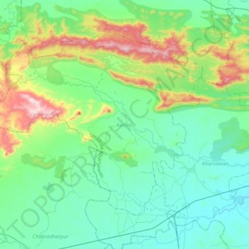
Name: Kuchai topographic map, elevation, terrain.
Location: Kuchai, Seraikela Kharsawan, Jharkhand, 833214, India (22.72576 85.51283 22.94440 85.83696)
Average elevation: 328 m
Minimum elevation: 157 m
Maximum elevation: 908 m
Other topographic maps
Click on a map to view its topography, its elevation and its terrain.