
Eatons Hill Boundary topographic map
Interactive map
Click on the map to display elevation.
About this map
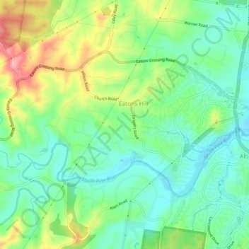
Name: Eatons Hill Boundary topographic map, elevation, terrain.
Location: Eatons Hill Boundary, Queensland, Australia (-27.35400 152.91091 -27.32780 152.96111)
Average elevation: 52 m
Minimum elevation: 9 m
Maximum elevation: 132 m