
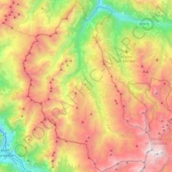
Les Belleville topographic map
Interactive map
Click on the map to display elevation.
About this map
Name: Les Belleville topographic map, elevation, terrain.
Average elevation: 1,919 m
Minimum elevation: 499 m
Maximum elevation: 3,533 m
Other topographic maps
Click on a map to view its topography, its elevation and its terrain.
Saint-Jean-de-Belleville
France > Auvergne-Rhône-Alpes > Les Belleville
Saint-Jean-de-Belleville, Les Belleville, Albertville, Savoy, Auvergne-Rhône-Alpes, Metropolitan France, 73440, France
Average elevation: 1,806 m
Sur la Roche
France > Auvergne-Rhône-Alpes > Les Belleville
Sur la Roche, Saint-Jean-de-Belleville, Les Belleville, Albertville, Savoy, Auvergne-Rhône-Alpes, Metropolitan France, 73440, France
Average elevation: 1,426 m