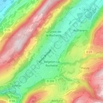
Valgelon-La Rochette topographic map
Interactive map
Click on the map to display elevation.
About this map
Name: Valgelon-La Rochette topographic map, elevation, terrain.
Average elevation: 539 m
Minimum elevation: 305 m
Maximum elevation: 1,219 m

Click on the map to display elevation.
Name: Valgelon-La Rochette topographic map, elevation, terrain.
Average elevation: 539 m
Minimum elevation: 305 m
Maximum elevation: 1,219 m