
Martindale topographic map
Interactive map
Click on the map to display elevation.
About this map
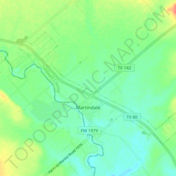
Name: Martindale topographic map, elevation, terrain.
Location: Martindale, Caldwell County, Texas, United States of America (29.82885 -97.87018 29.86744 -97.80079)
Average elevation: 165 m
Minimum elevation: 149 m
Maximum elevation: 196 m