
Qir topographic map
Interactive map
Click on the map to display elevation.
About this map
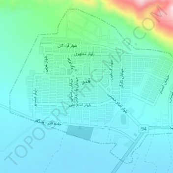
Name: Qir topographic map, elevation, terrain.
Location: Qir, بخش مرکزی, Qir and Karzin County, Fars Province, Iran (28.46950 53.02182 28.49423 53.05324)
Average elevation: 778 m
Minimum elevation: 727 m
Maximum elevation: 1,023 m