
Thiès Region topographic map
Interactive map
Click on the map to display elevation.
About this map
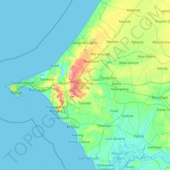
Name: Thiès Region topographic map, elevation, terrain.
Location: Thiès Region, Senegal (14.05379 -17.16176 15.45438 -16.12083)
Average elevation: 16 m
Minimum elevation: -5 m
Maximum elevation: 139 m
Other topographic maps
Click on a map to view its topography, its elevation and its terrain.