
Gaeta topographic map
Interactive map
Click on the map to display elevation.
About this map
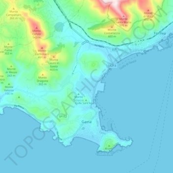
Name: Gaeta topographic map, elevation, terrain.
Location: Gaeta, Latina, Lazio, 04024, Italy (41.20384 13.48454 41.26524 13.59118)
Average elevation: 89 m
Minimum elevation: -2 m
Maximum elevation: 659 m
Other topographic maps
Click on a map to view its topography, its elevation and its terrain.