
Alumy Creek topographic map
Interactive map
Click on the map to display elevation.
About this map
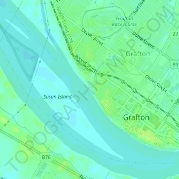
Name: Alumy Creek topographic map, elevation, terrain.
Location: Alumy Creek, Grafton, Clarence Valley Council, Australia (-29.68751 152.92367 -29.68671 152.92586)
Average elevation: 5 m
Minimum elevation: -1 m
Maximum elevation: 11 m
Australia trails, hiking, mountain biking, running and outdoor activities
Other topographic maps
Click on a map to view its topography, its elevation and its terrain.