
Grenada County topographic map
Interactive map
Click on the map to display elevation.
About this map
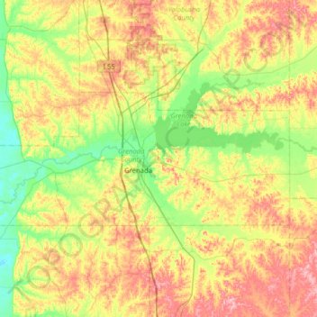
Name: Grenada County topographic map, elevation, terrain.
Location: Grenada County, Mississippi, United States (33.67708 -90.13770 33.89798 -89.50655)
Average elevation: 90 m
Minimum elevation: 36 m
Maximum elevation: 170 m
Other topographic maps
Click on a map to view its topography, its elevation and its terrain.
Oseola McCarty Park
United States > Mississippi > Forrest County > Hattiesburg
Average elevation: 53 m
Kosciusko
United States > Mississippi > Attala County > Kosciusko > Kosciusko
Average elevation: 132 m