
Talaud Islands topographic map
Interactive map
Click on the map to display elevation.
About this map
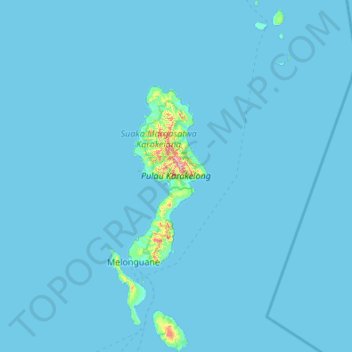
Name: Talaud Islands topographic map, elevation, terrain.
Location: Talaud Islands, North Sulawesi, Sulawesi, 95885, Indonesia (3.72798 126.60793 4.80740 127.16342)
Average elevation: 8 m
Minimum elevation: 0 m
Maximum elevation: 626 m
Other topographic maps
Click on a map to view its topography, its elevation and its terrain.