
Cross Roads topographic map
Interactive map
Click on the map to display elevation.
About this map
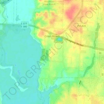
Name: Cross Roads topographic map, elevation, terrain.
Location: Cross Roads, Denton County, Texas, United States (33.19110 -97.02185 33.25256 -96.97629)
Average elevation: 172 m
Minimum elevation: 153 m
Maximum elevation: 204 m
Other topographic maps
Click on a map to view its topography, its elevation and its terrain.
Mayhill
United States > Texas > Denton County > Denton
Mayhill, Denton, Denton County, Texas, 76208, United States
Average elevation: 183 m
Westlake
United States > Texas > Denton County
Westlake, Denton County, Texas, United States
Average elevation: 199 m