
Senj topographic map
Interactive map
Click on the map to display elevation.
About this map
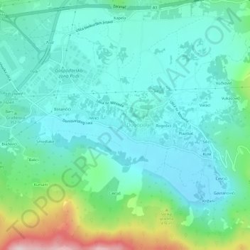
Name: Senj topographic map, elevation, terrain.
Location: Senj, Općina Dugopolje, Split-Dalmatia County, 21204, Croatia (43.56239 16.57235 43.60239 16.61235)
Average elevation: 353 m
Minimum elevation: 260 m
Maximum elevation: 688 m