
Apennin topographic map
Interactive map
Click on the map to display elevation.
About this map
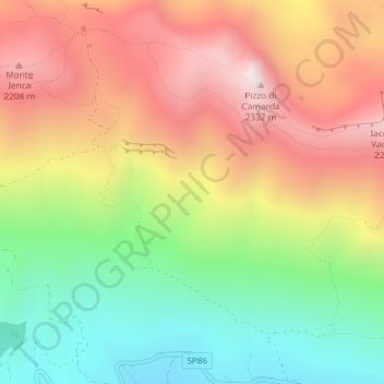
Name: Apennin topographic map, elevation, terrain.
Location: Apennin, L'Aquila, Abruzzen, Italien (42.45439 13.46662 42.45449 13.46672)
Average elevation: 1,735 m
Minimum elevation: 1,153 m
Maximum elevation: 2,348 m
Der Apennin beginnt im Nordwesten Italiens und bildet im Ligurischen Apennin die Fortsetzung der Ligurischen Alpen. Die Grenze zwischen Alpen und Apennin bildet der Col di Cadibona (436 m). Von dort reicht der Apennin Richtung Osten über die Apuanischen Alpen bis zur Adriaküste, wo er sich nach Süden wendet und im Abruzzischen Apennin mit dem Massiv des Gran Sasso d’Italia (2912 m) seine größte Höhe erreicht.
Other topographic maps
Click on a map to view its topography, its elevation and its terrain.