
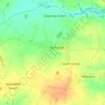
Mattishall topographic map
Interactive map
Click on the map to display elevation.
About this map
Name: Mattishall topographic map, elevation, terrain.
Average elevation: 48 m
Minimum elevation: 29 m
Maximum elevation: 67 m
Other topographic maps
Click on a map to view its topography, its elevation and its terrain.
Litcham
United Kingdom > England > Norfolk > Breckland District
Litcham, Breckland District, Norfolk, England, United Kingdom
Average elevation: 63 m
Moat
United Kingdom > England > Norfolk > Breckland District > Old Buckenham
Moat, Old Buckenham, Breckland District, Norfolk, England, United Kingdom
Average elevation: 51 m
Breckland District
United Kingdom > England > Norfolk > Breckland District
Breckland District, Norfolk, East of England, England, United Kingdom
Average elevation: 37 m
Thetford
United Kingdom > England > Norfolk > Breckland District
Thetford, Breckland District, Norfolk, England, United Kingdom
Average elevation: 32 m