
Baxter topographic map
Interactive map
Click on the map to display elevation.
About this map
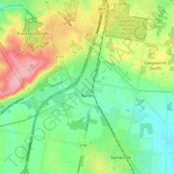
Name: Baxter topographic map, elevation, terrain.
Average elevation: 74 m
Minimum elevation: 22 m
Maximum elevation: 161 m
Other topographic maps
Click on a map to view its topography, its elevation and its terrain.
Somerville
Australia > Victoria > Somerville
Somerville, Shire of Mornington Peninsula, Victoria, 3912, Australia
Average elevation: 54 m