
Villshärad topographic map
Interactive map
Click on the map to display elevation.
About this map
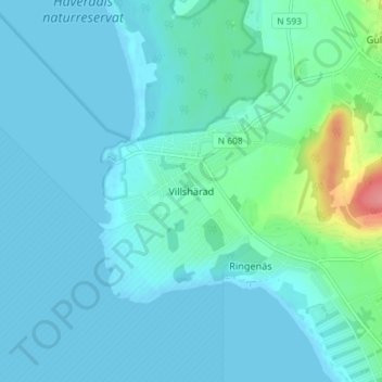
Name: Villshärad topographic map, elevation, terrain.
Location: Villshärad, Halmstads kommun, Halland County, 310 42, Sweden (56.67114 12.67588 56.71114 12.71588)
Average elevation: 11 m
Minimum elevation: -1 m
Maximum elevation: 78 m
Other topographic maps
Click on a map to view its topography, its elevation and its terrain.
Hasslöv
Hasslöv, Laholms kommun, Halland County, Sweden
Average elevation: 70 m