
Richmond Range National Park topographic map
Interactive map
Click on the map to display elevation.
About this map
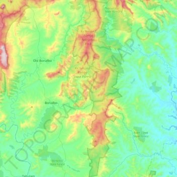
Name: Richmond Range National Park topographic map, elevation, terrain.
Average elevation: 244 m
Minimum elevation: 38 m
Maximum elevation: 854 m
Other topographic maps
Click on a map to view its topography, its elevation and its terrain.
Capeen
Australia > New South Wales > Capeen
Capeen, Kyogle Council, New South Wales, Australia
Average elevation: 283 m