
Werribee Gorge State Park topographic map
Interactive map
Click on the map to display elevation.
About this map
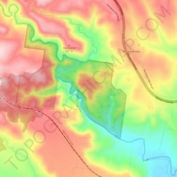
Name: Werribee Gorge State Park topographic map, elevation, terrain.
Average elevation: 285 m
Minimum elevation: 120 m
Maximum elevation: 411 m
Other topographic maps
Click on a map to view its topography, its elevation and its terrain.
Pentland Hills
Australia > Victoria > Pentland Hills
Pentland Hills, Shire of Moorabool, Grampians, Victoria, 3341, Australia
Average elevation: 293 m