
Dodges Ferry topographic map
Interactive map
Click on the map to display elevation.
About this map
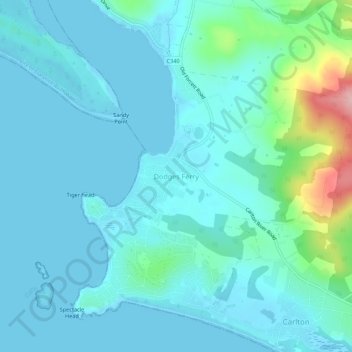
Name: Dodges Ferry topographic map, elevation, terrain.
Location: Dodges Ferry, Tasmania, 7173, Australia (-42.87360 147.60185 -42.83360 147.64185)
Average elevation: 25 m
Minimum elevation: -1 m
Maximum elevation: 175 m