
Taunggyi topographic map
Interactive map
Click on the map to display elevation.
About this map
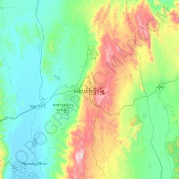
Name: Taunggyi topographic map, elevation, terrain.
Average elevation: 1,149 m
Minimum elevation: 884 m
Maximum elevation: 1,873 m
Taunggyi (Burmese: တောင်ကြီးမြို့; MLCTS: taung kri: mrui. [tàʊɰ̃dʑí mjo̰]; Shan: ဝဵင်းတူၼ်ႈတီး Shan pronunciation: [weŋ˥ ton˧˧˨ ti˥]) is the capital and largest city of Shan State, Myanmar (Burma) and lies on the Thazi-Kyaingtong road at an elevation of 4,712 feet (1,436 m), just north of Shwenyaung and Inle Lake within the Myelat region. Taunggyi is the fifth largest city of Myanmar, and has an estimated population of 380,665 as of 2014. The city is famous for its hot air balloon festival held annually on the full moon day of Tazaungmon.