
Kīlauea topographic map
Interactive map
Click on the map to display elevation.
About this map
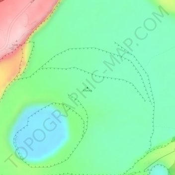
Name: Kīlauea topographic map, elevation, terrain.
Location: Kīlauea, Hawaiʻi County, Hawaii, 96718, United States (19.41381 -155.27586 19.41391 -155.27576)
Average elevation: 1,096 m
Minimum elevation: 1,022 m
Maximum elevation: 1,244 m
Kīlauea is the second-youngest product of the Hawaiian hotspot and the current eruptive center of the Hawaiian–Emperor seamount chain. Because it lacks topographic prominence and its activities historically coincided with those of Mauna Loa, Kīlauea was once thought to be a satellite of its much larger neighbor. Structurally, Kīlauea has a large, fairly recently formed caldera at its summit and two active rift zones, one extending 125 km (78 mi) east and the other 35 km (22 mi) west, as an active fault of unknown depth moving vertically an average of 2 to 20 mm (0.1 to 0.8 in) per year.
Other topographic maps
Click on a map to view its topography, its elevation and its terrain.
Kailua-Kona
United States > Hawaii > Hawaiʻi County
Kailua-Kona, Hawaiʻi County, Hawaii, 96840, United States
Average elevation: 100 m
Mauna Kea
United States > Hawaii > Hawaiʻi County
Mauna Kea, Hawaiʻi County, Hawaii, United States
Average elevation: 3,978 m