
Tzintzuntzan topographic map
Interactive map
Click on the map to display elevation.
About this map
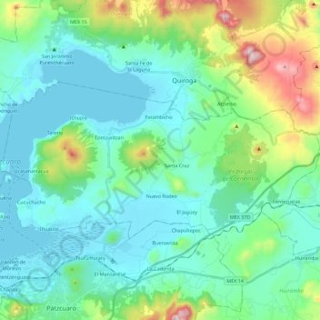
Name: Tzintzuntzan topographic map, elevation, terrain.
Location: Tzintzuntzan, Michoacán de Ocampo, México (19.55917 -101.65280 19.66251 -101.42938)
Average elevation: 2,201 m
Minimum elevation: 2,034 m
Maximum elevation: 2,849 m