
Deua National Park topographic map
Interactive map
Click on the map to display elevation.
About this map
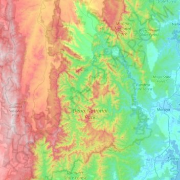
Name: Deua National Park topographic map, elevation, terrain.
Average elevation: 510 m
Minimum elevation: -3 m
Maximum elevation: 1,458 m
Other topographic maps
Click on a map to view its topography, its elevation and its terrain.
Deua River
Australia > New South Wales > Deua
Deua River, Deua, Eurobodalla Shire Council, New South Wales, 2537, Australia
Average elevation: 385 m