
St Helens topographic map
Interactive map
Click on the map to display elevation.
About this map
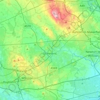
Name: St Helens topographic map, elevation, terrain.
Location: St Helens, North West England, England, United Kingdom (53.38537 -2.82504 53.53141 -2.57663)
Average elevation: 49 m
Minimum elevation: 6 m
Maximum elevation: 175 m