
Lake Kwania topographic map
Interactive map
Click on the map to display elevation.
About this map
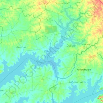
Name: Lake Kwania topographic map, elevation, terrain.
Location: Lake Kwania, Kachung, Dokolo, Northern Region, Uganda (1.59286 32.54047 2.15487 33.16807)
Average elevation: 1,062 m
Minimum elevation: 1,031 m
Maximum elevation: 1,247 m