
Prattville topographic map
Interactive map
Click on the map to display elevation.
About this map
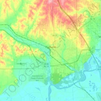
Name: Prattville topographic map, elevation, terrain.
Location: Prattville, Autauga County, Alabama, 36066, United States (32.40646 -86.55608 32.51092 -86.37221)
Average elevation: 88 m
Minimum elevation: 37 m
Maximum elevation: 199 m
Other topographic maps
Click on a map to view its topography, its elevation and its terrain.