
Scarborough Beach topographic map
Interactive map
Click on the map to display elevation.
About this map
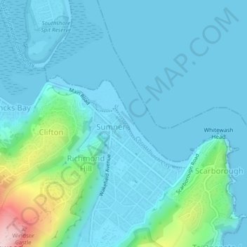
Name: Scarborough Beach topographic map, elevation, terrain.
Average elevation: 44 m
Minimum elevation: -11 m
Maximum elevation: 323 m
Other topographic maps
Click on a map to view its topography, its elevation and its terrain.
Christchurch
New Zealand > Canterbury > Christchurch
Christchurch, Linwood-Central-Heathcote Community, Christchurch City, Canterbury, 8011, New Zealand
Average elevation: 54 m
Twyford Reserve
New Zealand > Canterbury > Christchurch
Twyford Reserve, Bishopdale, Christchurch, Christchurch City, Canterbury, New Zealand
Average elevation: 21 m
Gebbies Valley
New Zealand > Canterbury > Christchurch
Gebbies Valley, Christchurch, Christchurch City, Canterbury, New Zealand
Average elevation: 100 m