
Oshawa topographic map
Interactive map
Click on the map to display elevation.
About this map
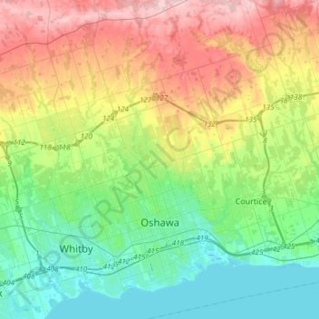
Name: Oshawa topographic map, elevation, terrain.
Location: Oshawa, Durham Region, Golden Horseshoe, Ontario, Canada (43.83207 -78.95877 44.04743 -78.78794)
Average elevation: 167 m
Minimum elevation: 71 m
Maximum elevation: 347 m
Other topographic maps
Click on a map to view its topography, its elevation and its terrain.