
Amlakit Yaylası topographic map
Interactive map
Click on the map to display elevation.
About this map
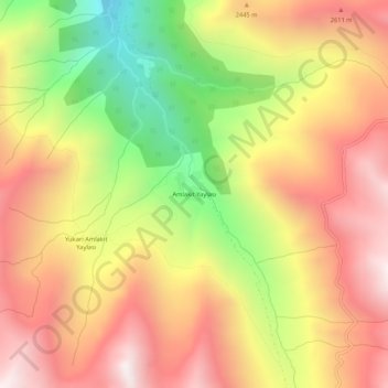
Name: Amlakit Yaylası topographic map, elevation, terrain.
Location: Amlakit Yaylası, Çamlıhemşin, Rize, Black Sea Region, Turkey (40.88116 41.05117 40.92116 41.09117)
Average elevation: 2,337 m
Minimum elevation: 1,635 m
Maximum elevation: 2,888 m