
Falun topographic map
Interactive map
Click on the map to display elevation.
About this map
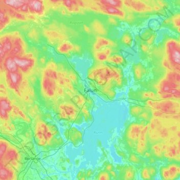
Name: Falun topographic map, elevation, terrain.
Location: Falun, Falu kommun, Dalarna County, 791 30, Sweden (60.44701 15.47231 60.76701 15.79231)
Average elevation: 184 m
Minimum elevation: 102 m
Maximum elevation: 397 m
Other topographic maps
Click on a map to view its topography, its elevation and its terrain.