
Doonan topographic map
Interactive map
Click on the map to display elevation.
About this map
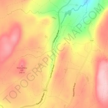
Name: Doonan topographic map, elevation, terrain.
Location: Doonan, Northern Ireland, United Kingdom (54.93960 -6.03839 54.96561 -6.00132)
Average elevation: 186 m
Minimum elevation: 56 m
Maximum elevation: 260 m
Other topographic maps
Click on a map to view its topography, its elevation and its terrain.
Old Mill
United Kingdom > Northern Ireland > County Antrim > Ballygally > Old Mill
Average elevation: 47 m