Geolocate

Dangar Island topographic map

Interactive map

Click on the map to display elevation.

About this map

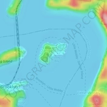
Name: Dangar Island topographic map, elevation, terrain.

Location: Dangar Island, Sydney, The Council of the Shire of Hornsby, 2083, Australia (-33.54239 151.23489 -33.53663 151.24398)

Average elevation: 17 m

Minimum elevation: -3 m

Maximum elevation: 153 m

Australia trails, hiking, mountain biking, running and outdoor activities

Other topographic maps

Click on a map to view its topography, its elevation and its terrain.

Bold Park

Australia > New South Wales > Sydney

Average elevation: 33 m

Badgerys Creek

Australia > Sydney

Average elevation: 79 m

Sydney Water Supply Canal

Australia > Sydney

Average elevation: 74 m

Hornby Lighthouse

Australia > Sydney

The wing for staff quarters in an "I" plan with enclosed verandahs either side. This building probably c. 1850s building having very good ashlar work to external walls with each elevation recessed within a frame of foundation, eaves and quoin mouldings. Windows are marked by simple classical sill and lintel…

Average elevation: 2 m

Morreau reserve

Australia > Sydney

Average elevation: 46 m

Wynyard Park

Australia > Sydney

Average elevation: 20 m

Callan Park

Australia > Sydney

Average elevation: 17 m

Sydney Water Supply Canal

Australia > Sydney

Average elevation: 82 m

Ropes Creek

Australia > Sydney

Average elevation: 103 m

Morrison Bay

Australia > Sydney

Average elevation: 18 m

Sydney Water Supply Canal

Australia > Sydney

Average elevation: 110 m

Russel Street Reserve

Australia > Sydney

Average elevation: 25 m

Currency Creek

Australia > Sydney

Average elevation: 25 m