
Bermuda topographic map
Interactive map
Click on the map to display elevation.
Bermuda
Bermuda consists of more than 150 limestone islands, but 5 main islands, along the southern margin of the Bermuda Platform, which is one of three topographic highs found on the Bermuda Pedestal. This Bermuda Pedestal sits atop the Bermuda Rise, a mid-basin swell surrounded by abyssal plains. Initial uplift of this rise occurred in the Middle to Late Eocene and concluded by the Late Oligocene, when it subsided below sea level. The volcanic rocks associated with this rise are tholeiitic lavas and intrusive lamprophyre sheets, which form a volcanic basement, on average, 50 m below the island carbonate surface.
About this map
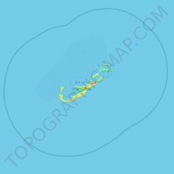
Name: Bermuda topographic map, elevation, terrain.
Location: Bermuda, Devonshire, DV04, Bermuda (31.98182 -65.08036 32.62182 -64.44036)
Average elevation: 0 m
Minimum elevation: 0 m
Maximum elevation: 68 m
Other topographic maps
Click on a map to view its topography, its elevation and its terrain.