Geolocate

Molesworth topographic map

Interactive map

Click on the map to display elevation.

About this map

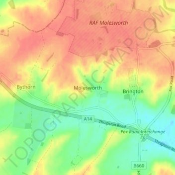
Name: Molesworth topographic map, elevation, terrain.

Location: Molesworth, Cambridgeshire, Cambridgeshire and Peterborough, England, PE28 0QD, United Kingdom (52.35049 -0.44697 52.39049 -0.40697)

Average elevation: 57 m

Minimum elevation: 29 m

Maximum elevation: 79 m

Other topographic maps

Click on a map to view its topography, its elevation and its terrain.

Wistow

United Kingdom > England > Cambridgeshire

Wistow, Huntingdonshire, Cambridgeshire, Cambridgeshire and Peterborough, England, United Kingdom

Average elevation: 21 m

Wandlebury Country Park

United Kingdom > England > Cambridgeshire > Stapleford

Wandlebury Country Park, Stapleford, South Cambridgeshire, Cambridgeshire, Cambridgeshire and Peterborough, England, United Kingdom

Average elevation: 46 m