
Gordon Park topographic map
Interactive map
Click on the map to display elevation.
About this map
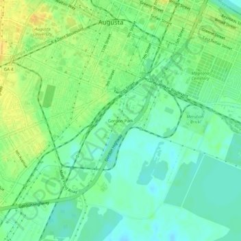
Name: Gordon Park topographic map, elevation, terrain.
Location: Gordon Park, Richmond County, Georgia, 30901, United States (33.43458 -81.99289 33.47458 -81.95289)
Average elevation: 42 m
Minimum elevation: 31 m
Maximum elevation: 56 m