
Yaroslavl Oblast topographic map
Interactive map
Click on the map to display elevation.
About this map
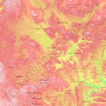
Name: Yaroslavl Oblast topographic map, elevation, terrain.
Location: Yaroslavl Oblast, Central Federal District, Russia (55.21820 36.44211 60.33820 41.56211)
Average elevation: 150 m
Minimum elevation: 64 m
Maximum elevation: 310 m
Other topographic maps
Click on a map to view its topography, its elevation and its terrain.