Geolocate

Bugsuk Island topographic map

Interactive map

Click on the map to display elevation.

About this map

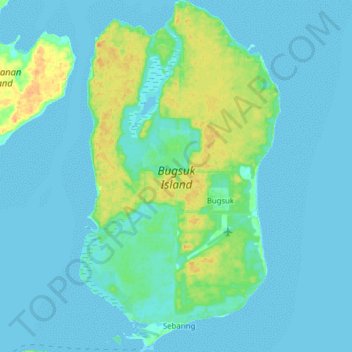
Name: Bugsuk Island topographic map, elevation, terrain.

Location: Bugsuk Island, Balabac, Palawan, Mimaropa, Philippines (8.17579 117.26322 8.33059 117.35285)

Average elevation: 6 m

Minimum elevation: -2 m

Maximum elevation: 28 m

Other topographic maps

Click on a map to view its topography, its elevation and its terrain.

Taytay

Philippines > Palawan

Average elevation: 54 m

San Vicente

Philippines > Palawan

Average elevation: 8 m

El Nido

Philippines > Palawan

Average elevation: 33 m

Puerto Princesa

Philippines > Palawan > Puerto Princesa

Average elevation: 92 m

Port Barton

Philippines > Palawan > Port Barton

Average elevation: 79 m

Bacungan

Philippines > Palawan > Bacungan

Average elevation: 22 m

Man-udoc

Philippines > Palawan > Puerto Princesa > Man-udoc

Average elevation: 37 m