
Trundle topographic map
Interactive map
Click on the map to display elevation.
About this map
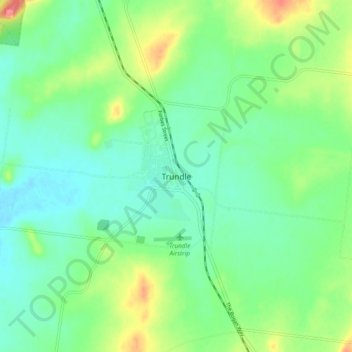
Name: Trundle topographic map, elevation, terrain.
Location: Trundle, Parkes Shire Council, New South Wales, Australia (-32.96362 147.67040 -32.88362 147.75040)
Average elevation: 262 m
Minimum elevation: 242 m
Maximum elevation: 305 m