
Illela topographic map
Interactive map
Click on the map to display elevation.
About this map
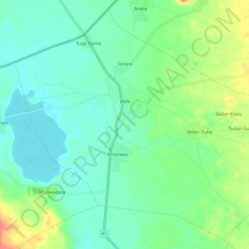
Name: Illela topographic map, elevation, terrain.
Location: Illela, Sokoto State, Nigeria (13.67450 5.25257 13.76572 5.35404)
Average elevation: 273 m
Minimum elevation: 258 m
Maximum elevation: 308 m