
San Cristóbal topographic map
Interactive map
Click on the map to display elevation.
About this map
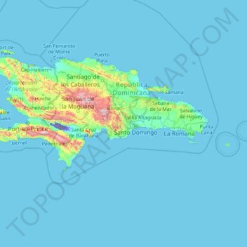
Name: San Cristóbal topographic map, elevation, terrain.
Location: San Cristóbal, Dominican Republic (15.92009 -72.80768 21.12009 -67.60768)
Average elevation: 83 m
Minimum elevation: -44 m
Maximum elevation: 2,839 m
Other topographic maps
Click on a map to view its topography, its elevation and its terrain.