
Lorne topographic map
Interactive map
Click on the map to display elevation.
About this map
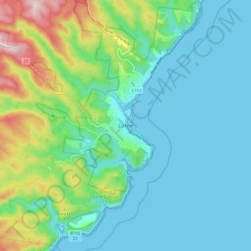
Name: Lorne topographic map, elevation, terrain.
Location: Lorne, Surf Coast Shire, Victoria, 3232, Australia (-38.58117 143.93482 -38.50117 144.01482)
Average elevation: 91 m
Minimum elevation: -3 m
Maximum elevation: 398 m
Victoria trails, hiking, mountain biking, running and outdoor activities